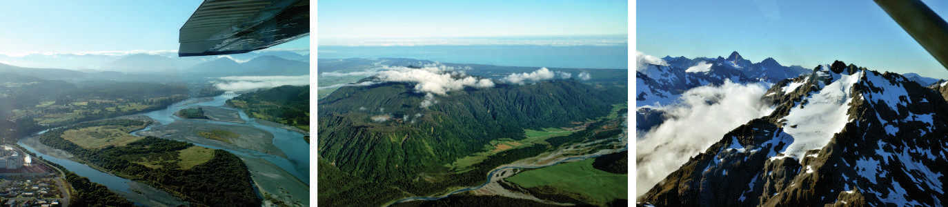
It's Saturday and a day for laundry so we have a somewhat lazy Saturday morning as the washer runs. After putting the clothes on the line we decide to tackle some of the trek that runs along the Wanaka river. We are hoping to walk to the dam where the river meet Lake Hawea. 
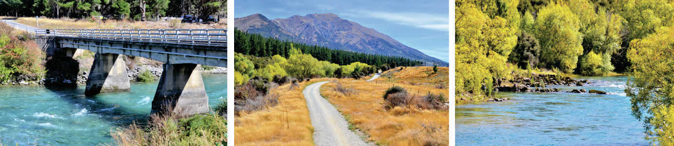
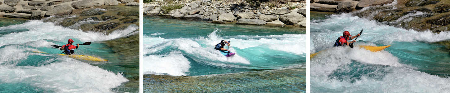
We drive to Camp Hill Road, park in the small lot before the one lane bridge, and start walking north on the trail. We learn that this section is the Wanaka Whitewater Park. We enjoy looking at the rapids and the kayaker's having fun on the rapids. 
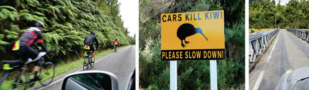
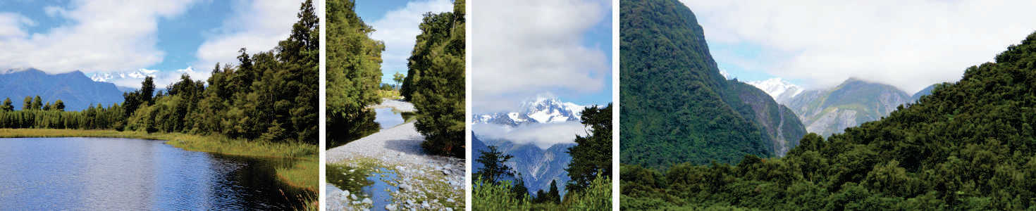
The path is shared with walkers and bicyclists, and we meet both types. Everyone is happy on this sunny, 20C (68F) afternoon. The views at some points are stunning. After walking for a while we pull out google maps and realize that the dam is much further up the river than we expected. We turn around and head back, enjoying the views in reverse.
0 Comments
It's very windy on this Friday as we drive 20 minutes to the city if Wanaka at the base of Lake Wanaka. This is a city tourists flock to, and is the location of the regional I-Site which provides tourist information. Our first stop is the I-Site to get some local trail maps and other information. Based upon a recommendation from our waiter from last night we drive 10 minutes out of town toward Mount Aspiring for a stop at Rippon Winery. The view of Lake Wanaka is unbelievable. During the wine tasting we learn of the bio-dynamic techniques used in the vineyard, including the use of Scottish Longhorn Cattle for fertilization and chickens for bug control. In my estimation the 2012 Pinot Noir and the 2015 Gewürztraminer are their stars. We return to the town of Wanaka to check out the shops. I look for a wool sweater, but like most everywhere else all I can find is wool-possum blends (yes, the dumb animals that get run over in the road each spring). I am not willing to venture there - what happened to 100% wool? William spies Alibaba's Barber Shop. With Paul and Kara's wedding ~ a week away, this sounds like perfect timing. William puts his name on the whiteboard and waits his turn. On Thursday evenings after 5pm they offer a free beer with a cut. There's no beer in sight today, except at the bar next door. 10 minutes later it's his turn and another 20 minutes and $20 later he is neatly trimmed.
Since William did not get a beer with his hair cut and didn't partake of the wine tasting we stop for a local brew at one of the many restaurants facing the lake. Then we are off to the New World supermarket for some groceries. As we walk through the aisles I hear at least five different languages being spoken. So much fun! After three nights in Hokitika we pack up the car and aim for the town of Lake Hawea. The day is mostly overcast - what a difference from yesterday when we were flying. We were so lucky with the weather! Our route is Highway 6 along and through the Southern Alps. We've picked out a few spots to stop along the way to break up the day. Our first stop is Okarito, a little less than two hours south. William turns off of the highway on the road to the beach town. It is supposed to have a pretty lagoon, some hiking and a cafe. When we arrive the cafe turns out to be part of the kayak rental place with a couple of picnic tables and the lagoon looks ok, but not special. Oh well, we just wasted 30-40 minutes. Highway 6 takes us into the small town of Franz Joseph, and the starting point of trails to the Franz Joseph Glacier. It's overrun with tourists in hiking gear, but we stop at a cafe for coffee. We also fill up our gas tank which puts William more at ease (we can sometimes drive for 1-2 hours without seeing a gas station). Our next stop is Lake Mathison, near Fox Glacier. There is a 20-30 minute walk to the lake. On a clear, calm day you can capture a photograph of Mount Cook and Mount Tasman with them reflecting in the lake. The clouds part for a little while we are on our hike and we are able to capture the beautiful mountains, but by the time we arrive at the lake the clouds are back. While I am stubbornly taking photos anyway, William chats with a couple from Highland Park, Illinois. It really is a small world. As we are driving along the coast we see a sign for Knights Point Lookout and can't resist. The parking lot and lookout are right next to the highway! It's a wonderful rocky coastline below with some stretches of sand below us. Out at the point some seals are sunning themselves on the sand. But in the 10 minutes we are out of the car the sand flies descend upon us. We brave the outdoors for a couple more minutes to put on our natural bug repellent, which helps significantly on future stops. It also makes our car smell like Lemon Pledge.
We decide to splurge and take a scenic flight to see the New Zealand Southern Alps. We meet Ben, our pilot and the owner of Wilderness Wings, at the Hokitika Airport at 9 am. We are joined for the flight by Graham and Christine from Dumfries, Scotland. Ben provides us with safety information and then helps us into our seats in the six passenger Cessna. We all have our headsets on and seat belts fastened as Ben asks for clearance from the tower. He taxies down the runway and we're off! The flight is very smooth as Ben takes us up to 8,000-10,000 feet. He expertly flies us toward and around the mountains, Providing commentary and stories throughout the flight. Shortly after taking off we see Lake Hahinapua. Then there are small mountains and lush valleys. The rivers are an incredible blue-green. The first large mountain peak we come to is Elie du Beaumont, elevation 3,111 meters (10,200 feet). There is a smaller Tasman glacier on the side of the mountain. We circle around and are off to see Frank Joseph Glacier followed by the Fox Glacier. Ben flies us remarkably close to Mount Tasman (3,500 meters) and Mount Sefton (3,150 meters), then we fly toward the summit of Mount Cook (3,724 meters). The scenery is breathtaking. Some of the ice on the mountain peaks has a beautiful blue tint. Ben turns the plane around and flies approximately the same route on the way back, which is gives everyone on the plane a chance to see the same sights. Ben is in contact with a helicopter flying in the same vicinity and William spots it - seemingly so far below us. An hour and 15 minutes later we are back at Hokitika Airport, bubbling with excitement from our experience. This experience was definitely worth the money. Tuesday we decide to explore the area around Hokitika. Although the city is the second most populated on the west coast of the South Island, there are only 3,600 residents. There's not much to see in-town. However it is large enough to support the approximate one million visitors each year. We start with a 20 minute drive to Lake Kaniere. It is a beauty. Along the lakeshore is the Kahikatea Forest Walk. Similar to some other trees native to New Zealand the kahikatea was over-harvested as the export industry grew years ago and now the trees are only found in small areas. The path through the trees is dense and eerie. We are half expecting a hobbit to appear around the next bend in the path. Further around the lake is the Canoe Cove Rimu Forest Walk. As you can guess, we walk for about 40 minutes through rimu trees and around Canoe Cove. A nice walk. Back in the car William points the car toward the top of the lake. The paved road turns to gravel and becomes more narrow. We go over a multitude of one lane bridges and around curves and begin to wonder if we are on the right road. But, we go over another bridge and see one of the green and gold Department of Conservation signs. We have arrived at Dorothy Falls. Yeah! The bottom 2/3rds of the falls are visible from the bridge and there is a short path that takes us to the base. It's very picturesque- exactly what I think a waterfall in the wilderness will be. There's only one other couple at Dorothy Falls. They're from north of Auckland and are spending several months enjoying the South Island. We confer about the route to Hokitika Gorge, our mutual next destination, then we leave them to their picnic lunch. We're starting to get hungry. We have water, but made the mistake of not bringing snacks. We think we'll find a cafe on our route, but alas we do not. We vow to never go out exploring again without some provisions to tide us over. After 40 minutes of farm fields and pretty scenery we arrive at Hokitika Gorge Swingbridge. The gorge is mostly granite while the Hokitika River and it's pools are a beautiful milky blue-green from the copper and other minerals in the water. We hike to the swingbridge and then across it. It's a little worrysome that the sign limits the bridge to six people at a time, but the bridge only mildly sways and bounces. On the other side of the river and a little further upstream there are groups of people swimming in the pools and sunbathing on the rocks. A perfect afternoon activity! We head back to Hokitika for a "dunch" (dinner/lunch). Toward evening we walk into the city center and onto the beach. Hokitika Beach receives a lot of driftwood and a couple of weeks ago there was a driftwood sculpture competition. Many of the sculptures remain and/or new sculptures have been added. A fair number of people have gathered on the beach for the sunset. It is beautiful and there's a cheer when the last bit of sun goes below the horizon. |
AuthorHi. I'm Anne. I wander around the world with William. Enjoy Some of our Favorite Links below
Archives
March 2023
Categories
All
|